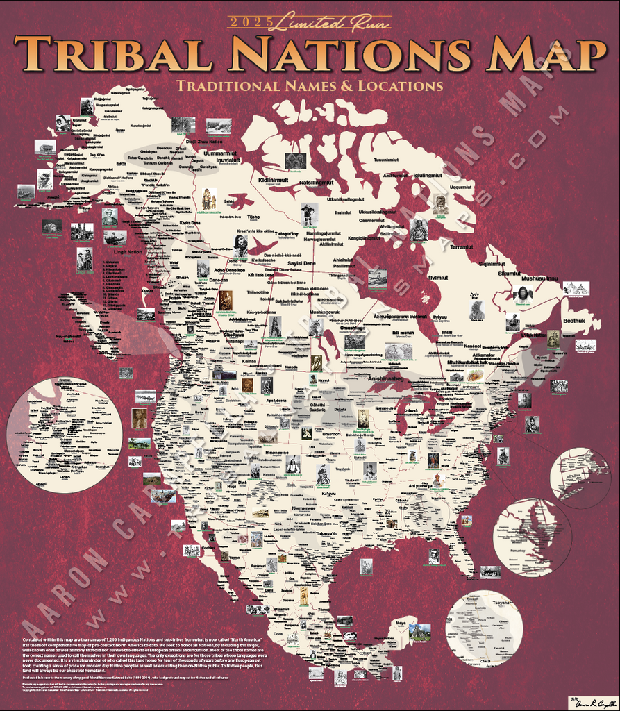
This large-format Native American tribal nations map is the most detailed and historically accurate indigenous peoples map of North America available for educational purchase. Measuring 48"×55", it documents over 1,700 historic tribal locations — using the traditional name each nation calls itself in its own language (autonym) alongside its commonly recognized English name.
Standard maps erase thousands of years of indigenous civilization by showing only colonial-era borders. This pre-contact Native American map corrects that record, drawing on decades of ethnographic research, archival documentation, and consultation with tribal cultural directors, elders, and linguists.
Schools, universities, museums, libraries, and cultural centers use this map as a foundational resource for Native American history, indigenous studies, geography, and social studies curricula.
Order this Native American tribal nations wall map — the definitive educational map of indigenous North America.