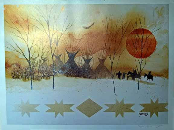
The Tipis - BY ARTIST ANDERSON BENALLY (NAVAJO) (1954 - 2013) - 29W X 22H is a comprehensive, historically accurate indigenous peoples map documenting the pre-contact homelands of Native American and indigenous nations across North America. Uses traditional indigenous language names (autonyms) and commonly recognized English names.
This map fills a critical gap in standard education: most published maps of North America show only colonial-era political boundaries, erasing thousands of years of indigenous civilization. Draws on decades of ethnographic scholarship, archival documentation, and consultation with tribal cultural specialists and elders.
Order the Tipis - BY ARTIST ANDERSON BENALLY (NAVAJO) (1954 - 2013) - 29W X 22H and enrich your educational program with an authentic, accurate indigenous peoples map today.