Native American Nations + American Indian Reservations - Map Set Posters

SKU: IPR-MAP-RES-US-PST-V6
Availability: Many in stock
$139.97

QTY:

Native American Reservation Map – 24"x36" Native American Nations + 24"x36" American Indian Reservations - Map Set Posters | Educational Classroom Wall Map

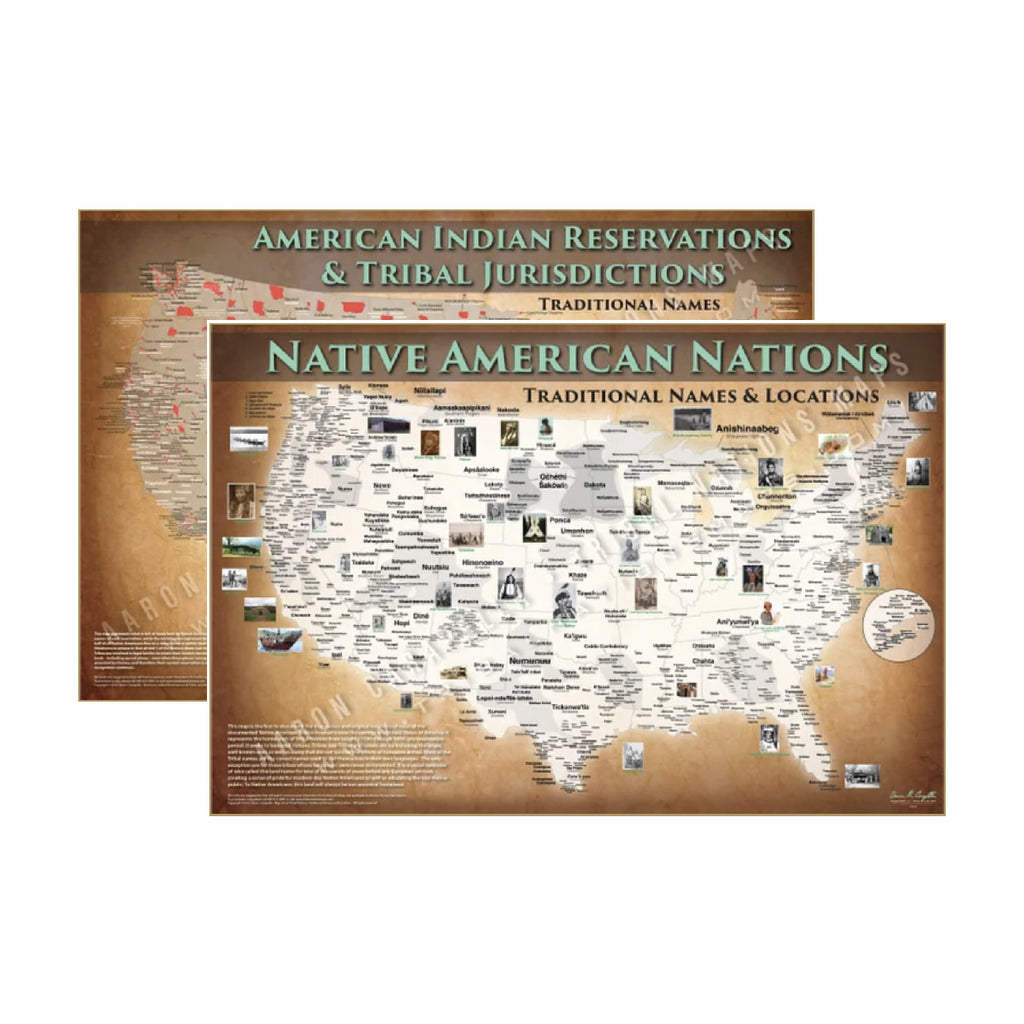
The 24"x36" Native American Nations + 24"x36" American Indian Reservations - Map Set Posters is a detailed, accurate Native American reservation boundary map showing current land areas held in trust for federally recognized tribal nations across North America. Essential for social studies classrooms, university geography departments, legal professionals, tribal government offices, and museums.

  • Accurate Native American reservation boundary map of North America
  • Shows federally recognized tribal land areas, trust lands, and jurisdictions
  • Available as poster, laminated, canvas (rolled), canvas on frame, and foam board
  • Premium fade-resistant inks on high-quality materials
  • Ideal for classrooms, universities, libraries, museums, and tribal offices
  • Essential for social studies, geography, and Native American studies curricula
  • Size: 24"x36" — ships rolled in a protective tube

Add the 24"x36" Native American Nations + 24"x36" American Indian Reservations - Map Set Posters to your classroom or office and give students accurate geographic context for Native American land and sovereignty.