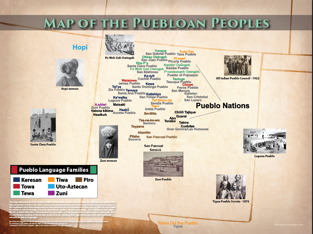
The Map of the Puebloan Peoples – Native American Wall Map is a comprehensive, historically accurate indigenous peoples map poster documenting the pre-contact homelands and territorial areas of Native American and indigenous nations across the region. This map uses both traditional indigenous language names (autonyms) — the names each nation calls itself — and commonly recognized names, creating an accessible, culturally respectful educational resource for learners, educators, and cultural institutions of all kinds.
This map addresses a critical gap in standard geographic and historical education: most published maps of this region show only colonial-era political boundaries, erasing thousands of years of indigenous civilization, governance, and presence. This pre-contact indigenous territory map corrects that record, drawing on decades of ethnographic scholarship, archival documentation, and consultation with tribal cultural specialists, elders, and linguists to produce the most accurate representation available.
Whether you are a teacher developing a curriculum unit on indigenous history, a museum curator creating a geographic exhibit, a researcher studying pre-colonial land use, or a member of an indigenous community seeking to document your nation's homeland, this map provides the geographic foundation your work requires.
Order the Map of the Puebloan Peoples – Native American Wall Map and enrich your educational program, library, or cultural exhibit with an authentic, accurate indigenous peoples map today.