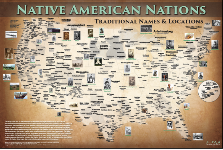
The Native American Nations Map - 24"x36" Poster and Lesson Plan (K-3) is a comprehensive, historically accurate indigenous peoples map documenting the pre-contact homelands of Native American and indigenous nations across North America. Uses traditional indigenous language names (autonyms) and commonly recognized English names.
This map fills a critical gap in standard education: most published maps of North America show only colonial-era political boundaries, erasing thousands of years of indigenous civilization. Draws on decades of ethnographic scholarship, archival documentation, and consultation with tribal cultural specialists and elders.
Order the Native American Nations Map - 24"x36" Poster and Lesson Plan (K-3) and enrich your educational program with an authentic, accurate indigenous peoples map today.